I pop out of bed at 4:45.
I’d spent the previous evening making sure the bikes were all ready to go for our 6 AM start, but woke up around 3 and did the toss and turn maneuver until I got up. All the rolling around and I had decided to drastically change the form of our summit bid, we were taking snowshoes.
It wasn’t a secret nor was it going to be some sort of surprise that there was snow before we hit the summit. We drove our route the week prior and you could see snow on the south facing ridge. There was going to be snow and plenty of it. The condition of that snow and its depth were the biggest unknowns. If we had firm snow, it wouldn’t really matter how much, but if we had soft snow that was deep, well, that’s post holing for miles.
And nobody likes post holing.
My restless sleep had convinced me that we were going to have lots of snow and it was going to be soft. We were going to need snowshoes to hit the summit. I jumped out of bed and started changing my bike plans. I installed the front rack and began strapping on the shoes. There was no way to get them on that rack without hitting my brake levers which was going to make going up the steep ass climb impossible. Ok, remove front rack, install back rack. No dice and I am running out of precious time to get this sorted. It became painfully obvious that I was either too tired or this just wasn’t going to work. I rip the back rack off and we’re back to the same place we were when I went to sleep, but now I have about 15 minutes to finish getting ready for the ride. I’ve had zero calories and about 2 sips of my coffee which may have also contributed to not getting the snowshoes on the bike.
Well, we’re in this for whatever it is. Let’s go to the mountains.
The idea of Lounge to Summit is pretty simple. Starting from the Mooseknuckler Cycling Alliance Social Lounge, we do our best to get to the highest point in Washington County, Signal Peak, but we do the whole thing under our own power because that’s what we do.
It’s kind of like a mini version of Lowest to Highest. Obviously, we lose a couple thousand feet by starting higher and Pine Valley Mountain doesn’t have the same elevation as Mount Whitney, but it’s still a big day. And yes, we could start at the lowest point in the county, but that’s clear over in Beaver Dam and only drops us another 350 feet, but would add miles to the ride. So we start here, at the Lounge and gain a shit ton elevation in an attempt to get to the summit.
It’s one of the few rides where you start and you can say that it is all uphill from here. You can see the top as you roll out and there are very few places where you will be coasting and those are pretty short.
Mentally I break down this climb into three distinct parts.
Part 1
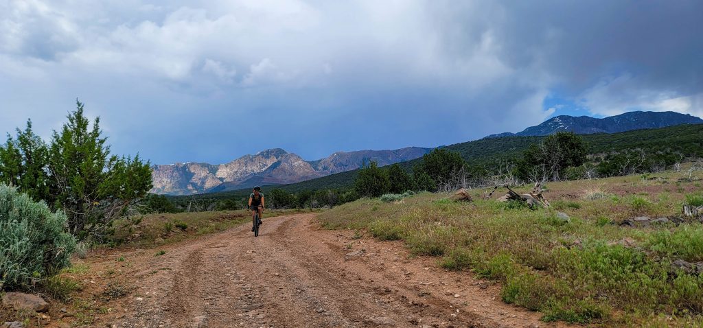
The climb up Turkey Farm is well known and most cyclists have pedaled it many times. It’s one of my favorite places in the county especially in the morning. The way the sun pops across the grasses and mesa casting a light that makes Pine Valley glow in a spectacular manner. Add in the almost due north nature of the route and you don’t see anything other than open space. It only takes a few miles and you feel like you are in the middle of nowhere heading deeper into the wild.
The grade is mostly a casual pedal with only a few steeper sections to keep you interested, but you climb a couple thousand feet by the time you hit FR 901. The change in elevation takes you through a few different transition zones. Starting in the desert with its cactuses and grasses, you transition into sage, juniper and pinyon around the Broken Mesa Trailhead. And as you keep going higher, the trees get more dense and the flowers start to change. By the time you’ve turned the corner on the 901, you are in the P&J forest looking up at the largest laccolith in North America. The elevation gain levels off as the road turns into rollers until you turn off onto FR 033 or colloquially known as the FR666.

Part 2
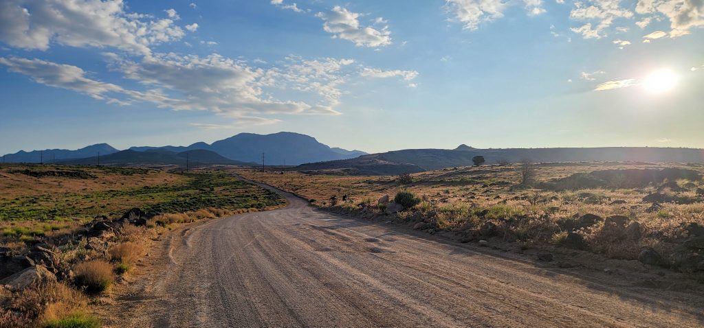
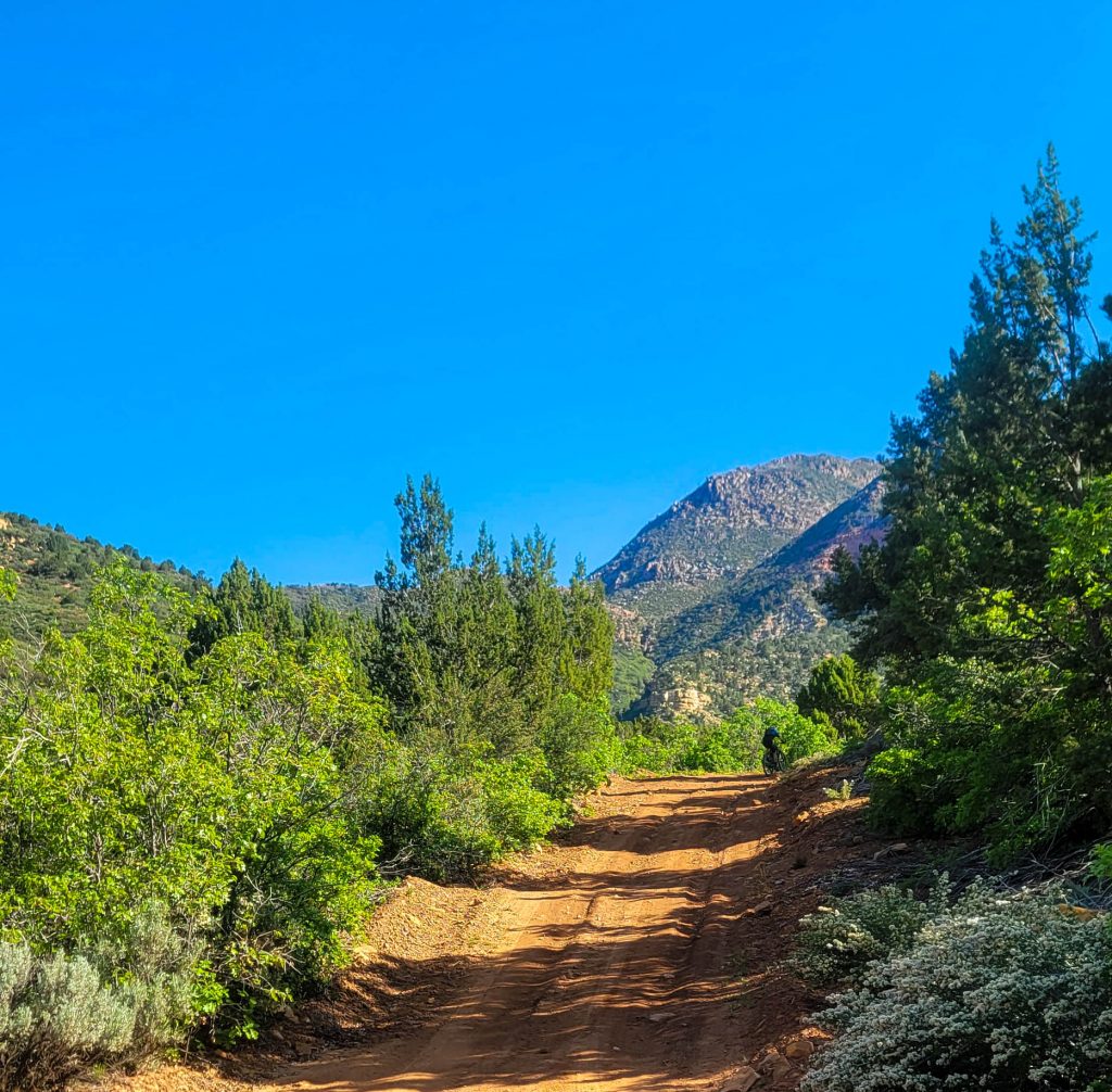
FR666 contrasts the Turkey Farm. It immediately adds to the remote feeling you are already experiencing by being rougher, narrower and wilder. It drops off at first with a steep little descent and then switchbacks up only to lose elevation a second time. And then you start climbing.
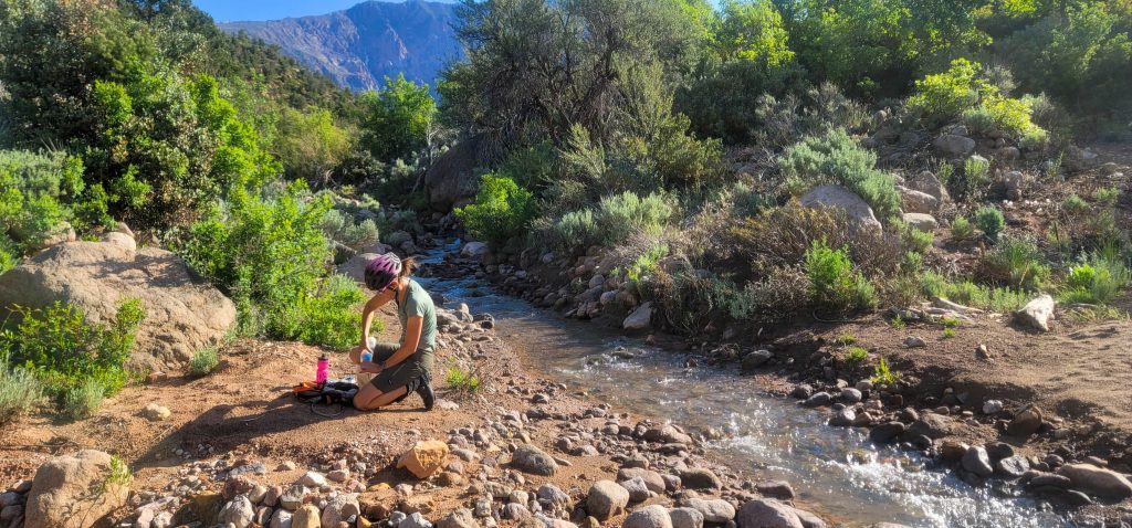
The first couple of miles are a relatively easy grade. You certainly know you are climbing, but it isn’t crazy as the road follows the draw and parallels the currently running creek. It’s when you pass the Y and leave the main flow that the road gets a bit crazy. We stopped at this point and took advantage of the mountain clear water to top off our supply getting ready for even more climbing.
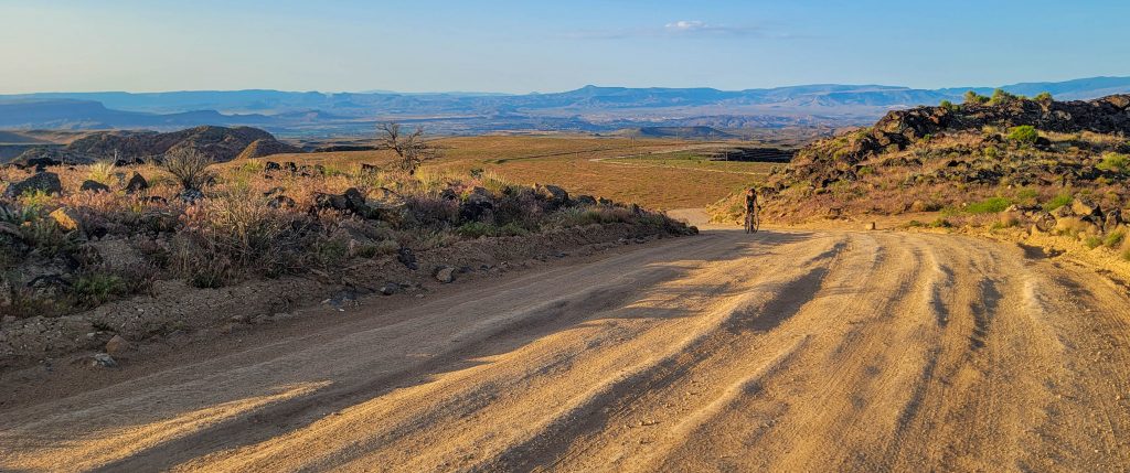
The road then pitches up. The grade is so steep that the Forest Service has built in grade reversals to keep water from destroying the road on the regular. These provide the scant relief from the grade that exists. The farther up the road you go, the steeper shit gets.
Pierce has been more or less soft pedaling the entire ride up to this point so we can ride together, but he does have a goal of cleaning this climb. As we leave the creek, he quickly pulls away and then disappears. I keep pedaling with the faint hope of also cleaning the climb. I do so up to the point of the Turn. The Turn is a switchback that makes a hard right turn. You can’t actually see the climb around the corner but you can certainly tell by the way the road disappears that things are about to get hurty. I’m already in the cave, but keep myself moving around the corner and make it up just the first few yards before the loose dirt and being close to my max causes me to lose traction.
Getting started on this terrain is nigh impossible. It’s crazy steep and loose. I push for a few yards to get to one of the grade reversals. I’m surprised by how hard it is to even walk. Once at the slightly flatter section, I get back on and try to get going. My effort is pretty futile. It’s extraordinarily difficult to gain momentum and without the mo there isn’t much you can do to keep traction. I once again spin out and start walking. I repeat this process several times as I slowly move forward. At this point, I can see the switchback above me and keep a keen eye on the road to see if I can spot Pierce. He is nowhere to be seen.
I keep telling myself that the next switchback mellows out and it will be easy to pedal up to the top from there. It does mellow out, but it is anything from easy. The road tread is certainly less loose and the grade isn’t quite as steep, but it continues to flog you. I pedal the entirety of that switchback, but have to take a couple of breaks to catch my breath. I now keep an eye on the road below me to see where JT and Mama Bear are. Shelena has driven to the trailhead and is hiking down toward us. We can seen John and she continues down as I head up.
I know that once I round the last switchback the road mellows even a bit more and it’s only a short distance to the top. What I don’t recall is that the last switchback is on a cinder bed meaning you are now pedaling in gravel that is a couple of inches thick. I almost immediately wash out and give up on the entire endeavor pushing my bike to the top. It’s about this time that Pierce starts riding back down to meet me. He almost got the whole climb washing out in the same cinder gravel that I just did.
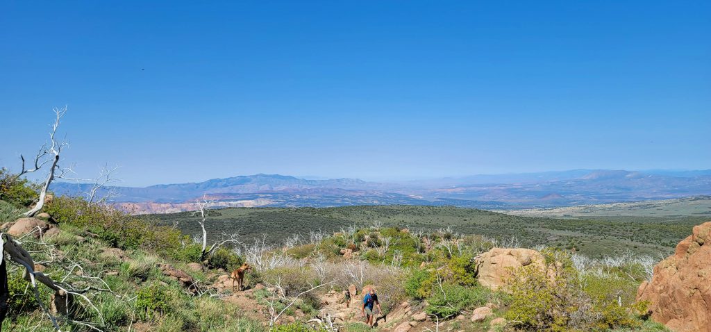
The views just keep getting better and better. As you get closer to the mountain, it becomes possible to see the variation in the geology of the mountain. The reds and blacks that you can’t quite see from town or front and center. It reminds me of why I love this mountain and keep coming back. It’s not only close to home, it’s a pretty rad mountain.
Of course, as we climb the prominence, the views to the south become bigger and bigger as well.
Part 3
And then we transition to the final stage of this ascent, bipedal mode.
We stash bikes at the Blake and Gubler trailhead, eat some snacks and change our shoes. At this point, we’ve climbed almost 5000 feet already and we now have a few thousand more to go to the summit.
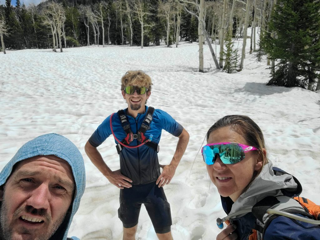
Blake and Gubler is not an easy hike. The trail almost immediately pitches upward switchbacking across the side of the mountain using the few shoulders that exist as landing pads to continue up. Each of those shoulders has distinct rock that I call spires and Pierce referred to as Middle Earth. Tall, skinny towers speckle the landscape. We almost immediately hit water and snow drifts. Water resupply is not going to be an issue on this attempt.
As we gain elevation, the trail begins to go into and out of snowdrifts. This trail isn’t used often and can be difficult to follow when you can see it. Adding in the snowdrifts makes navigation a bit more difficult and we wander around a bit. The snow is thankfully firm. As expected, the higher we get the more accumulation there is. Many sections of trail are covered with waves of snow creating a challenging obstacle course. Up one side and then sliding down the other. This continues until we start to hit the open meadows.
The snow in the meadows is soft as it is openly exposed to the sun. Luckily, it’s only about 6 inches deep. We get through the first open sections and then back into the trees the snow firms back up. The second section is bigger. The snow is softer and deeper and we are soon post holing to continue. We are getting close, but haven’t hit the Summit Trail yet. Despite a serious amount of climbing, the summit is still a thousand feet higher. Having climbed the mountain many times, I know that once on the Summit Trail, things get steeper and more difficult. With cold, wet feet and our turnaround being the start of any post holing, we call it.
There was no summit this time, but we did make it to over 9000 feet.
Now that we were done climbing, it was truly, all down hill from there.
At that turn around point, we knew we were mostly done. And by we, I mean Mama Bear and I. Pierce was jonesing for more hoping to get over 10,000 feet of climbing. We make it back to the trailhead and transition back to Pedal Mode. Pierce is off dropping to the spigot on the Diamond Valley side. We never see him a gain.
Mama Bear and I make it to the spigot, top off our water and then suffer through the jarring descent into Diamond Valley. This is the only section that makes me a little angry, but I watch the views, snap a few photos and remember to smile to keep me going. I also know that descent will end in a smooth road and then it’s pavement all the way home.

While we didn’t make it to the summit, I still call the day a success. We crushed over 7,000 feet of climbing (yes, Pierce got his 10,000. He’s a beast) and kicked off mountain season.
If this sounds fun, you should probably check yourself, but we’ll most likely make another attempt in about a month to see if we can get the whole thing checked off.
Embrace Chaos. Seek Discomfort.