What is the best bike for this route?
I struggle with best bike questions. Mostly because I have been accused of being a chronic underbiker. I like to ride stuff on bikes that make it harder to ride. In this particular case, I will be riding my singlespeed Chameleon.
With that said, I would recommend something in the mid-travel range. Full suspension would probably be a good idea. There are sections that a long travel bike is probably the best option, but pedaling a pig around isn’t going to do you any favors. One thing for sure, don’t bring a gravel bike. If I was to purchase a bike to make this route as easy as possible on me, I would probably snag a Tallboy or an Epic Evo. Something that can get rowdy but won’t slow you down too much on the dirt road sections.
How technical is it?
In general, this route is a way to connect the harder trails in Washington County. Our trails tend to be on the more technical side of things. Lots of rocks and rough stuff connected by dirt roads and a little bit of pavement.
The most technical sections, in order of tech, Grafton DH, Icehouse and the Honeymoon Trail. Grafton is a legit double black. It’s only a few miles long but you will most likely encounter full face helmets and 8″ travel bikes. Icehouse is mostly a fun downhill rip. The last half mile or so drops off the mesa and is steep, rocky and rowdy. And the Honeymoon Trail? Well, that’s actually an old Mormon trail that has been taken over by jeeps. It drops off the Hurricane Cliffs. Nobody rides it because it’s kind of hard to get to the top of it. It’s only a couple of miles, but is rocky, loose and steep.
That’s the worst stuff, but here’s a list of trails in the order the route goes. You can probably find Youtube videos for all of them.
- City Creek
- T-Bone
- Lange’s Dugway
- Icehouse
- Prospector
- Quail Creek
- Three Falls
- Goulds Rim
- Little Creek Mesa
- Gooseberry Mesa, South to North Rim
- Gander
- Grafton Wash
- Grafton DH
- Guacamole
- JEM
- Hurricane Rim
- Dead Ringer
- Honeymoon Trail
- Flyer Territory
- Kentucky Lucky Chicken
Resupply?
The route is never too far away from a town. We’ll start in downtown St. George, drop into Washington, roll through Hurricane, Apple Valley, Rockville and Virgin before returning to STG. There are plenty of stores and restaurants just off route. There is water on Little Creek Mesa marked as Camp 2 on the map. It’s a large pothole. I will be filtering it. Camp 3 is a cow pond that no longer sees many cows on Guacamole that will also be filterable. The route crosses the Virgin River both in Rockville and in Virgin. I filtered in Virgin last year.
As far as support, no one has even finished this route in the given amount of time. If you want to stash or have food/water delivered. I don’t care and will not hold it against you as far as saying you finished. There are a few people showing up to actually conquer this thing. If that happens, we will give priority to the finishers who were unsupported in the traditional bikepacking racing guidelines even though I think they are stupid.

Camping?
Most of this route rolls through BLM land with the exception of the small towns mentioned above. You could certainly find accommodations within those towns if needed. Dispersed camping is readily available along most of the route. We may or may not have illegally camped in the past just outside of Virgin. In general, if there aren’t houses or signs saying you shouldn’t camp, you’re probably fine. Especially if you are just throwing out a bivvy and passing out.
Can I drop bags?
Sure. One of the hardest parts of finishing this route is knowing it can be easily cut. Little Creek, Guacamole and Kentucky Lucky Chicken are all loops. If you want to remove your bags at the trailhead, ride the trail unloaded and then repack, that’s fine by me.
Bail Outs?
This route is contrived. It’s very specifically a way to connect a bunch of trails. There are multiple spots where mileage can be trimmed (see the above-mentioned loops). Plus, plenty of spots where you could just pedal back to STG. Make sure you know the route, have maps available and keep yourself in check. While the route does stay fairly close to towns, it also goes throw a few sections that are remote. Most notably, Lange’s Dugway and the roads between the Honeymoon and the Southern Parkway. Cell coverage depends on your carrier and I wouldn’t count on having coverage for the entire route.
Tracking?
Due to the difficulty of this route, it is more of a challenge than a race. I don’t have plans to setup a blue dot or otherwise. I’m not one to deny someone a high five in general and won’t be checking your Strava before doling them out at the finish line. If we do have people finish and care about who was the fastest, well, then we will look at whatever digital tracking they have to determine that they did do what they claim in the amount of time they claim. Otherwise, I don’t care. We’re pretty loose like that.
Do you have a gpx file?
Yes, I do. Download here.
What is the best way to pack?
Oh boy. Well, you’re gonna want to be light. And if you can, make sure you can use your dropper post. Yes, you will want one of those.
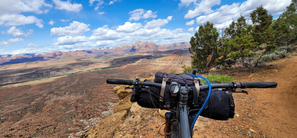
My general setup for this trip, handlebar bag, frame pack and backpack. My bedroll and clothes go in the handlebar bag. Water and food are in the frame pack. Everything else goes in the backpack. I’ve been able to get by with a water capacity of 3 liters. You will want to check the weather. If it’s in the 80s or you need water to cook, you might want more.
I hope that helps clarify things, but if it doesn’t feel free to hit me up and I’ll do my best to help you out. The Alliance looks forward to riding with you.
Update as of 3/29
It was brought to my attention that the gpx file started in the wrong location. The link above, Caltopo and Strava have been updated.
It was also asked if you were required to start Thursday evening. Nope, but the end time doesn’t change. You have to be done by Sunday at 5:30.
You are also not required to camp at the locations on the map. These are there as suggestions. You are welcome to crash anywhere you see fit.
Embrace Chaos. Seek Discomfort.
Well put. Light And you can buy layers en route. Hope I can hang on for this one again.
We’ll see how this goes!!!