There were several unknowns.
The knowns were these. We knew the distance. We knew there would be significant climbing and we knew that the trail was once passable. I threw in some good judgment and had several
The plan was a
It was just one of the unknowns.
Known.
This thing started quite pleasantly with a steep climb up a fairly well-graded road. This is a road we had both traveled before. The last time we were here, we had gone up to Barker and done some walking around with the dogs.
The North Fork Road goes up a canyon, a beautiful canyon with white sandstone walls and the occasional granary hidden within its recesses. The road then climbs up and out of this canyon to the mountains. Which is to say, it’s fairly flat until it’s not.
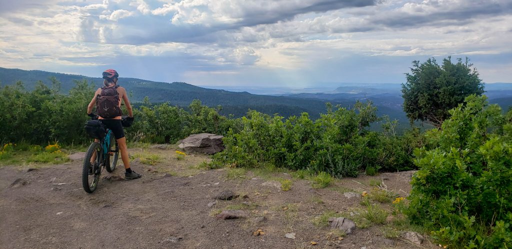
We awoke to a storm threatening and were glad to have the cloud cover as we made the climb. There was very little traffic, in fact, the only cars we saw were headed down and traveled together.
The climb does take you to the above lookout that was the first of many views we had looking back toward the desert that lies at the foot of these mountains. There is one more steep push and we were at the Barker Reservoir Complex. The camp host gave us a friendly hello with an eyebrow raised in a questioning manner. It may have all been my perception, but it felt like he was thinking, “Oh, I’ll see you guys in about 45 minutes.”
Unknown.
This is where we knew things would get interesting. We would find a trail that had been cleared and we could travel relatively quickly or it would be akin to what I assume it looks like when God plays pick up sticks. Or somewhere on the spectrum in between.
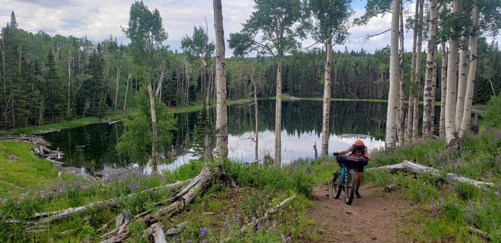
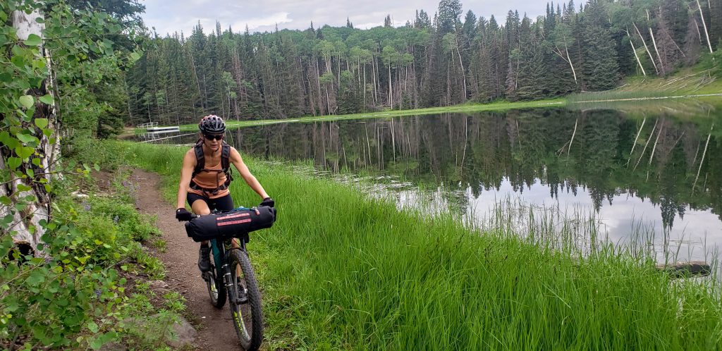
The trail was immediately steep. We found ourselves pushing up an incline to abrupt to pedal within the first 1/4 mile. Then we pedaled and had to cross a stream. We rode around the lake and then had to cross the stream. Within the first 1/2 mile, we had pushed at least twice, but it was probably closer to 3-5 times. Yet, no downed trees.
We continued on this program. Pedal, push, drag, walk, pedal, push, pedal, drag. Somewhere around mile 2, we hit our first downed trees. Within a quarter mile of that first one, we hit a downslope that had me worried enough that I went on a scouting expedition. Can we get through? Yes. Will it be easy? Nah.
Ok. I guess we’ll keep on keeping on…
Known.
Both of us had wanted to do this traverse for a while. It had been on my radar since sometime in the late 90s when I first headed out to ride trails in the Boulder Mountains. Back then, the Great Western Trail was still somewhat of a thing. Maintenance was being done and a bunch of amateur mountain bikers were able to piece together a 3 day trip of shuttling and pedaling bikes in the backcountry. For Kathleen Ann, she had her curiosity piqued when we first came to Escalante together and I took her to the places I knew, which were the mountains where I had spent my youth hunting with my family. The next trip, she showed me the desert, and well, we had somewhat forgotten about the mountains for a while.
The section of the GWT that we were on, goes from the Barker Reservoir Complex to Posey Lake, or just above it. It then continues toward Blue Spruce Campground and from there on to Boulder Town. And from there…
The GWT was part of Dave Harris’ original TransUtah route and is now included in the Plateau Passage. Two of what are probably the hardest bikepacking routes in the West and probably the country. Seeing that these routes are right through SG, it seems reasonable to start checking sections off the list. Also part of the motivation for this particular adventure.
Unknown.
We had not gone very far and yet, here it was lunch time.
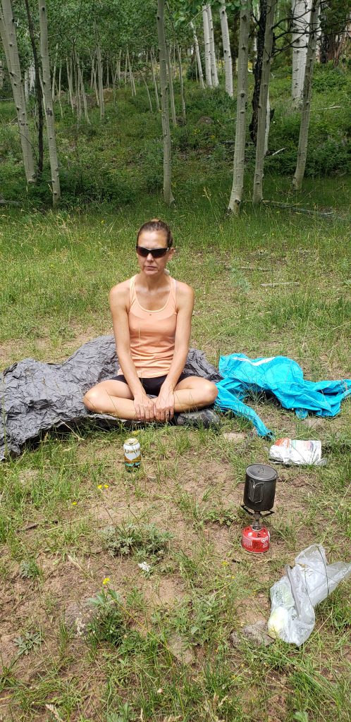
Typically, I am the one who struggles to catch my breath and more or less do anything, including sleeping, anywhere above 8000 feet. On this day, I felt great. I was stoked to be dragging my bike over downed trees, to be watching my wife pedal through a meadow where the trail just disappeared and pushing my bike up trail that was too loose and steep to even consider climbing. Mama Bear was not stoked.
In fact, she was having one of the worst days she has had. The elevation was kicking her ass which made each hike-a-bike just that much more difficult, each stream crossing a serious chore and those steep ups an exercise in suffering to just suffer.
Stopping for lunch was two fold. It was around that time and despite the words coming out of her mouth, I could tell food and rest were going to be good things for both of us.
A short bit after lunch and we came to a brand new, shiny gate in the middle of nowhere. We crossed through and found that from that gate to the dirt road dropping to Posey, the trail had been cleared. This meant that when the trail was not too steep or too rough, we could actually pedal instead of dragging our bikes around the mountain.
Known.
We hit the dirt road. There was a conversation, but we both knew that there was no way we were continuing into the unknown of what the trail was on the other side of the road. We knew we were dropping to Posey and that dirt road was how this was ending.
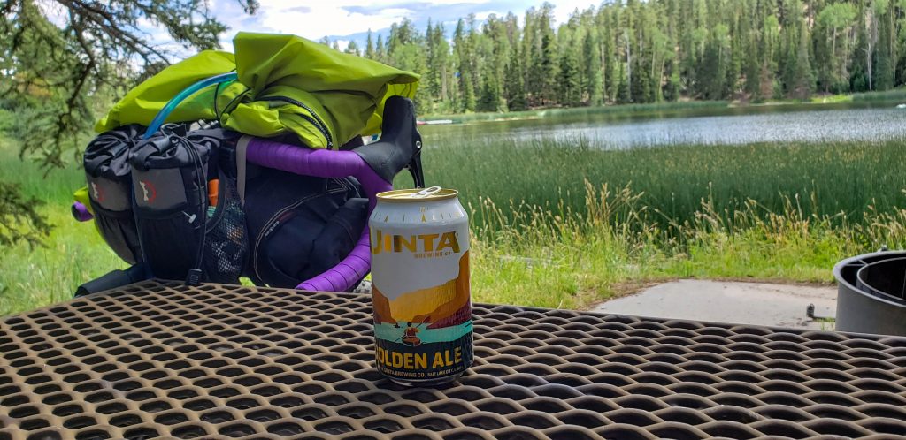
We rolled up to the lake to find out that the campground was one that requires money. Didn’t know that. As we contemplated what to do, we found our way to the picnic area, drank a beer and finished off the Funyons. We explored the possibility of poaching a site, but knowing that there was a good road that lead right back to our Tepui, we opted to finish out our loop.
Dropping from Posey, leads to some up and down that goes on for several miles. The road is benched and provides some amazing views of the Box Death Hollow Wilderness. We stopped several times just to bath in the surroundings and wonder about the unknowns that lie out that way.
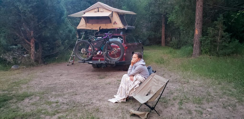
And then we descended to the North Fork Road. It was beginning to get hot and now we had to go back up as our car was another couple of miles past the turn off. This section of road seemed like it would never the way that the last section of any death march always feels like it is never going to end. And then we were there. 30 Miles of brutal bikepacking only to camp in our cartop tent.
Known vs Unknown
The best part of adventuring is the unknown. When you know everything that is going to happen, it’s not an adventure it’s just another trip. That doesn’t mean you just head out without a clue what you are doing or where you’re headed. Planning is very important, but it is that hint of not knowing how the whole thing is going to go that provides the adventure. It’s the reason that the best stories or the adventures that are most memorable are those that don’t go quite as planned.
And to be honest, I can’t seem to stop thinking about that unknown section just past the road to Posey.
P. L. and R.