Something told me.
Call it intuition, call it experience, call it prescience, call it the Holy Ghost. I don’t care what you call it, but something nestled in the depths of my brain told me it was going to be a long hike out of the canyon. I even mentioned as much when the question was raised as to how far it was back to the RVs.
I had little concern for the hike out regardless of the length. If there is one thing I feel like I have mastered, it’s walking. However, we had spent a great deal of time and effort getting to this section of almost unvisited desert and I wouldn’t have minded hanging out for another day. I knew the booze was running low. I knew that there was still 7 hours in the day before dark and that was a long time, but this was the first time I had been to this side of Cottonwood Canyon and I was interested in exploring. I defaulted to those who were saying how rad it was going to be to be back at the RVs drinking beer.
Well, let’s get going.
I don’t like to back into my opening paragraph. I tend to back into the story after the intro, it’s just what I do. So let’s go back to the planning stage.
The Planner was not able to make this trip.
The trip was a combination of ideas and groups that were thrown together last minute. John Taylor had drawn a line on a map (I thought it was a gpx track from someone who had already done this, but we’ll get back to that) and we had jumped in feet first hoping for adventure. And adventure doesn’t come easy or with knowing exactly how it’s going to turn out.
The loose plan was to go down Lewellyn Canyon, packraft around to Reflection Canyon and come back up Cottonwood Canyon and back to the cars. That is not what happened.
Before we even left cell service, I had some misgivings about going into a canyon with a 3-mile long slot. There was rain in the forecast. Problem with the forecast is that it is for places that are inhabited, where we were going isn’t. So we headed down the road with a “we’ll see how it looks when we get there” attitude. 1.5 hours later and 50ish miles of bouncing around on a dirt road, we made it to the trailhead.
The clouds that were building in Escalante, were now hovering just above us and moving in the direction of that aforementioned slot. Adventure is
Shuttle gets set up. There is giggling in the back of the Mooseknuckler Adventure Mobile 3.0 when I drop into a hole and pop a section of the bumper off, but we get to HITR. The clouds are still building.
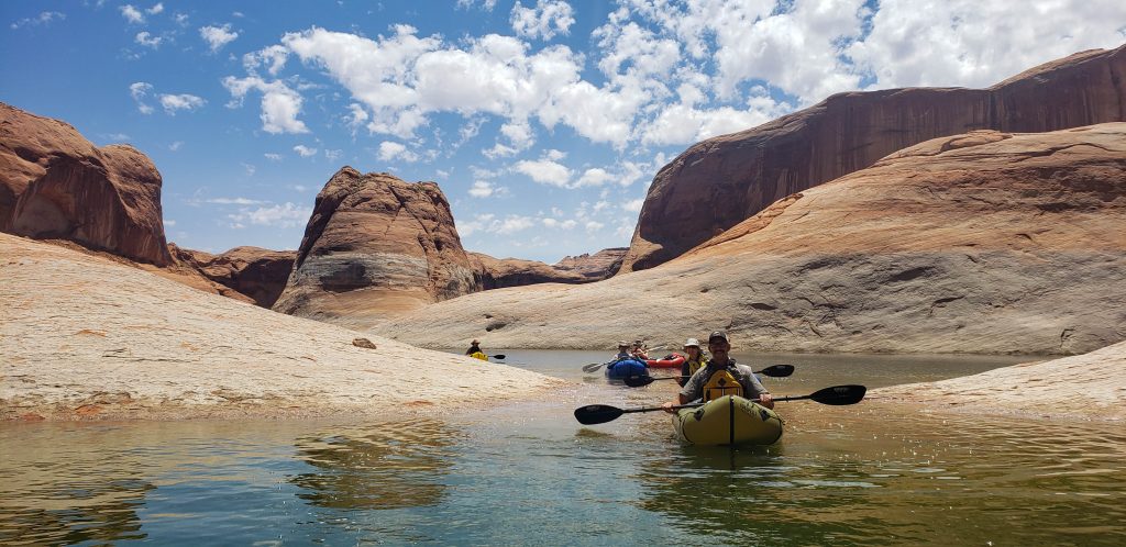
We gather the booze and other things we felt were essential for a few days in the desert, strap it to our backs and begin the journey that for some strange reason has become a main stay in our trips. Once at the “lake,” we switch from bimodal to packmodal and maybe drink a little.
From past experience, I know it isn’t too far across the lake unless the wind comes up and then it’s a jaunt you probably wouldn’t choose to do. Due to weather and our late start time, across the lake is the plan as the Escalante side doesn’t offer much in camping spots. We begin a leisurely paddle across. The clouds are building. We begin to hear thunder. Someone asks if anyone has been on the lake when lightning has struck. I raise my hand. I kinda grew up on this reservoir. We keep paddling. There is a crack of thunder that hits us all hard informing us that the storm we’ve been running from has arrived. Then the rain starts. I giggle. The thunder continues to roll off the ledges. The drops are huge. We hear a constant roar and turn around to see water shooting off the top of the cliffs. I giggle again, but Mama Bear is not happy and I go into helper mode.
Then the hail starts.
Our pace hastened. Some of us were quite enjoying the micro burst. Others were not. Needless to say, we reached the other side, the rain stopped, the water falls stopped and we paddled around looking for a descent campsite.
Heather was giddy.
She kept using the phrase “have to” over and over again. It was followed by “see the Moonflowers, they are soooo cool.”
I had never seen a Moonflower, but apparently our camp was surrounded by them. They are white and open at dusk in a dramatic fashion or at least as dramatic as a flower can be. They even make a popping noise when the pedals final snap apart. I thought I had got a video, but didn’t which is probably for the best as it would have been 5 minutes of us standing around staring at a flower as it slowly opens.
And a lot of “That is sooo cool!”
There was no sense of hurry in the morning. No impending doom on the horizon. An easy day was what we were expecting. No one had a clue that our day wasn’t going to end until just before the
We set out with a leisurely pace. Stopping on occasion to check out a feature or grab a snack or drink a beer. It was basically
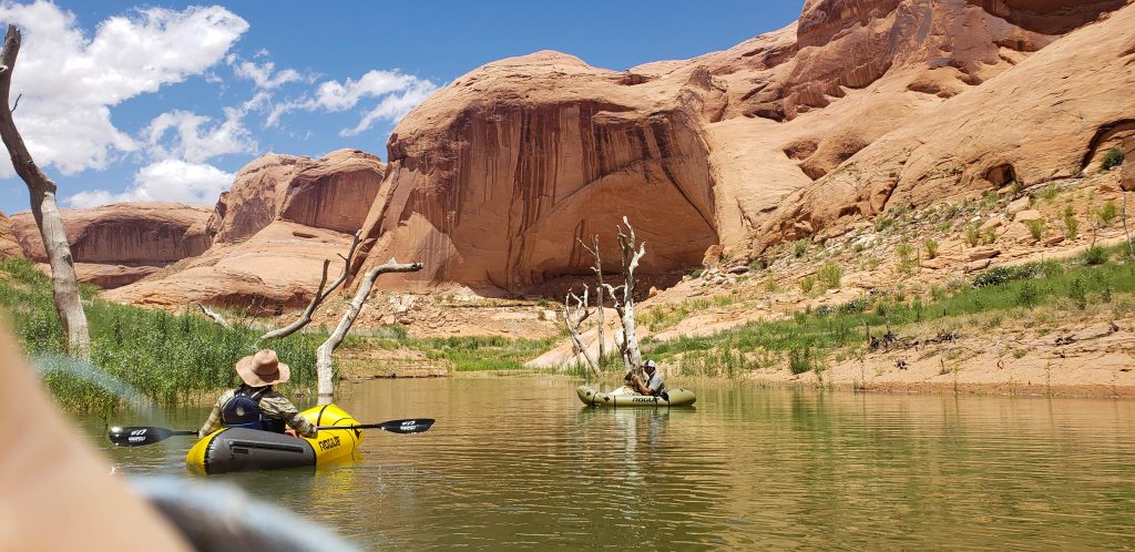
We floated into the canyon. The reservoir/stream interface was barely even gross. We climbed out of our boats and transitioned to bipedal mode.
And now we are back to where we started. I was ready for lunch having only had a bit of wine and one ProBar all day and it was somewhere around 2 PM. The conversation was breached of camping or heading out, the group decided to head out. So I skipped lunch.
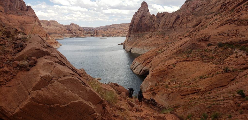
This side of Cottonwood Canyon is one of the wildest places I’ve been. No trail. No footprints. Once off the lake, you could argue humans hadn’t been there in ages. Our progress was slow. The reeds were taller than us, we were carrying heavy packs and the path of least resistance was the creek. The creek was choked with said reeds and beaver dams, legit dams backing up 3-4 feet of water in places. The silt left by the lake banked the creek with 10-30 foot piles of dirt that were nearly impossible to climb. The crawdads were everywhere.
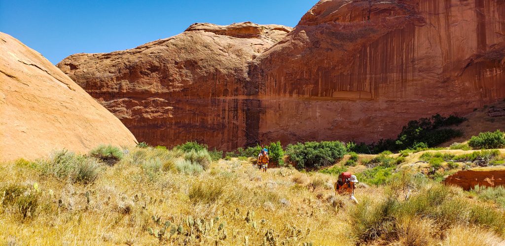
We trudged along.
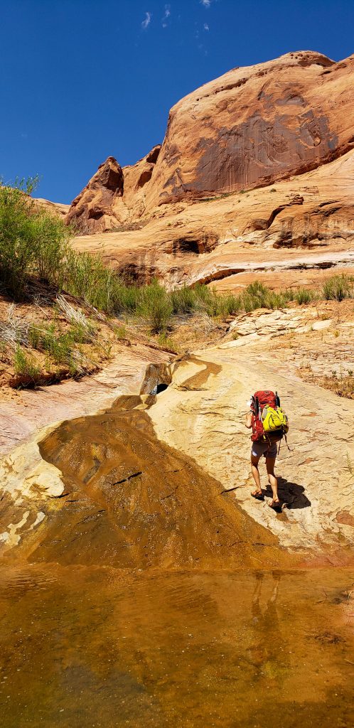
And then we had to find a way out of the canyon. This is where my thinking that the gpx that John had sent me was actually someone’s route came out. I was following it assuming it would lead us out of the canyon, not realizing it was just drawn as best he could tell on his computer. There was some up the canyon and back until he informed me of such.
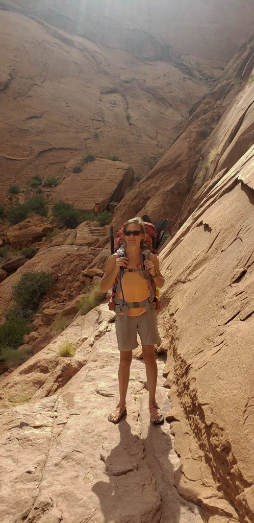
The climb out was steep. At times, we were using our hands to balance and make it up short sections. It was a scramble. Members of the group were already fatigued from the paddle and bushwack we had done. The climb out was the definitely the crux for physical exertion, but the hike to the trail and then the trail to the trailhead, were the psychological crux.
Are we there yet?
The gloaming light of the waning afternoon was beautiful as we traversed the top of the canyons back to the van. The Garmin put the trip at 21 miles (it wasn’t that long) and 10 hours 49 minutes of moving time.
Once at the van, the doors were popped open, beers were passed around and you could read it on the faces that we were satisfied. We had come to see the desert, parts of it that were new to us, and the route had let us experience the desert with its heat, dryness and cruelty. And it all just reaffirmed to me, that to love the desert is to embrace that cruelty.
It was a proper Desert Death March.


P. L. and R.
i always giggle at thunder. humor and humility offsets the stress.