This is all Lacey’s fault really.
For some unexplainable reason, I had never considered leaving from my house and getting to the top. I had schemed up bikepacking trips that turned into backpacking trips but those always dead-ended at having to either do an out and back or carrying your bike over the mountain. But just getting to the summit, the highest point in Washington County, completely under my own power was a new concept.
Lacey called it a link-up, running and riding to get up the mountain. I thought it was a cool idea and we schemed over maps a couple of times and then she did it.
I schemed, settled on a route and pitched it to a few people the Alliance. A date was decided upon and we were ready to do a thing.
And then we got the added bonus of a heat wave coming through.
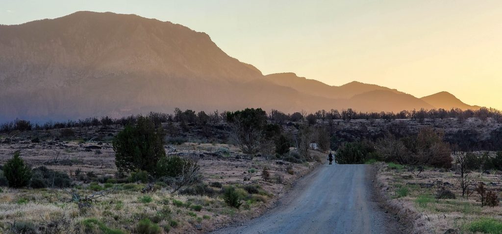
Stage 1 – To the Trailhead
The orange is bleeding over the hard line of the basalt ridge to our east. The looming elevation gain is clearly visible and the light is glowing across its face in preparation for the sunrise. We’ve been pedaling for about 45 minutes and still have plenty to go. I’ve ridden up the Turkey Farm road many times. To catch this landscape in this light always makes me smile and guarantees it’s going to be a good day (even more so than wearing chums).
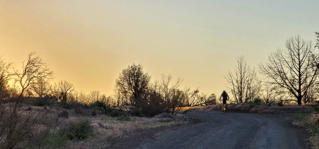
Stage 1 of this little challenge is the climb from town to the trailhead. There’s a bunch of different options, we (read I) opted for the most direct. Straight up Turkey Farm to the FS 033 which would take us right to the trailhead. The Turkey Farm Road climbs almost entirely uninterrupted from town for the first 15ish miles. There’s one or two steepish grades, but it’s actually a pretty pleasant grind. The 033 would account for the last 4 or 5 miles but would also climb almost as much as the TFR.
Let’s just say that the last few miles are steep as fuck. Steep enough that Eagle somehow made sense except that you are going so slow that if you start to wobble at all you’re gonna stop. And once you’re stopped, there isn’t any way you can get back on and start pedaling. There’s not many roads I would think of if someone asked me for a climbing challenge. This one would certainly fit the bill. Bring your big girl pants.
Stage 1 was just over 20 miles and 4300 feet of climbing.

Stage 2 – To the Top
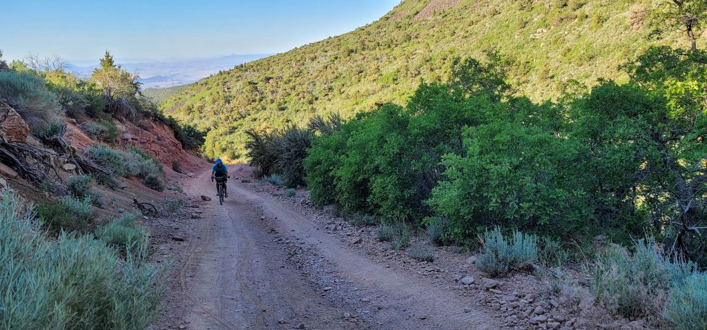
Seeing that there was a heat wave rolling through Southwestern Utah, the temps were top of mind. I was stoked to see that the trail was in the shade as we started the ascent. Blake and Gubler burned several years ago providing some pretty rad views but also removed any shade cover for the first couple of miles. We certainly had some hot moments, but stepping into the shade was like walking into a freezer and the first part of the climb was quite pleasant.
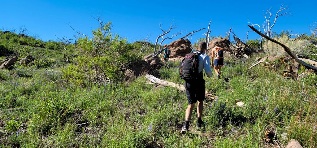
We finished up the Blake and Gubler section and started up the Summit Trail (just for reference, it does not actually take you to the summit, you’ve gotta bushwack to the highest point). From the intersection, the trail pitches up dramatically. With the amount of elevation we had already gained and the grade of the trail, we were all sucking wind. It turned into hike, stop to breath, hike, rest, hike, check out that view, OMG, this is rad, hike.
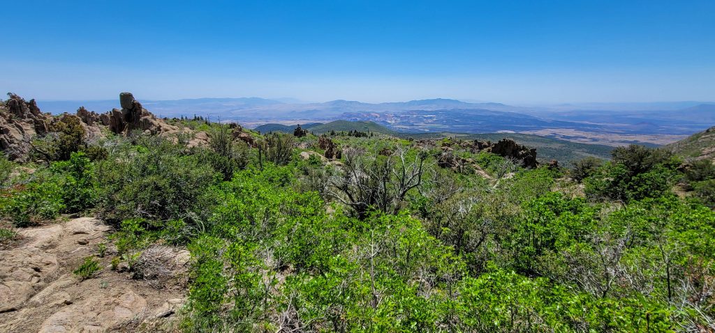
I’ve been to the top of the mountain quite a few times. I had just gone up Forsythe two days prior, but the views are always worth it. Standing on the top of a place gives you a different perspective and seeing the tumor from above provides a little bit of hope that the entire desert won’t end up paved over.
We made our way to the false summit and then to the summit (in my defense, I’ve always climbed this thing from the other side). We found the trail register, looked out over the valley again and then rested in the shade. As mentioned, it was Bill’s Befday so we celebrated with a beer while being the highest people in Washington County.
Sitting in the shade felt amazing. A cool breeze circulated through the pines and soon we were all cold. Finishing up the beer, we then prepared for our return to the valley. It’s an odd sensation on this type of adventure. You finish the out and celebrate only to have the back part sitting in front of you. At least it was pretty much all downhill.
We drop back to the Summit Trail. Scooting along at our Party Pace, we came around a corner to see a guy stretching on a log and checking his map. As soon as he notices us, he grabs his walking stick and takes off running. At first, I thought he just didn’t want to be behind us, but then he turns and high tails it straight up the sidehill. As we pass, he is hiding behind a tree and peaking around as if we somehow didn’t see him.
Strange? Hell yes.
Whatever.
Downward. We stop for a breather and to check the view. He catches back up to us and as soon as he can see us he again, sprints passed us and disappears. Ok. What the hell?!?
Turning back down the Blake and Gubler trail, the semi-maintained nature goes away and we are once again in the rugged, no one uses this and it is not maintained at all section of our adventure. The scrub oak grabs at us and the downed trees slow our progress.
At last, we make it back to the trailhead and our bikes just as we are sucking down the last of our water. Luckily, Bill was smart and stashed water for us.
Stage 3: Coasting, mostly, all the way home.
Transitioning back to pedal mode, we are all a bit spent. We’ve been moving for quite a while and still have 20 miles to get home. We also know that 98% of the way home is downhill, but that 2% is all we can think about.
Jumping on the two-wheeled love machines, we begin the descent. As I said, it’s steep. If you let off the brakes, you gain way too much speed, way too fast. We drag our brakes down the hill smoking the rotors and pads. If you’ve ever smelled your bicycle brakes get hot, you know it’s not exactly a good feeling, but that’s where we were at.
The heat wave that is engulfing the area comes with it’s own gusting winds. As these things go, that means we have a head wind. It’s enough downhill that the wind is mostly a benefit keeping us somewhat cool. That is until we hit the pavement and the last, tiny little section of not downhill is accompanied by a soul crushing, blow dryer style wind back to the Lounge.
I’ve been to the top of that mountain uncounted times. This was by far my favorite. No cars. Starting from home. Good friends. It makes me wonder if it is disengenous to say you’ve climbed any mountain if it isn’t done this way. Probably not, but…
Embrace Chaos. Seek Discomfort.