 I don’t know who said it. Probably because I don’t care, but someone, somewhere said the two fastest ways to die in the desert are thirst and drowning.
Thirst
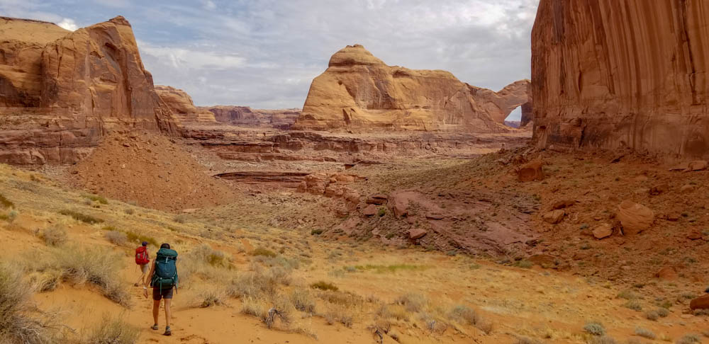
Somebody pitched this as an easy trip, a sort of paradise in the desert. We would have an easyish hike over some sandstone, drop down a sand dune to a desert oasis as we enjoyed cool temps in the shade of the alcoves and cooled off in the clear water as it cascaded over the sandstone. That somebody had experienced that trip and was expecting this one to be much like the other times they had been in Coyote Gulch, especially that previous time in July when there was no one around.
That somebody was me.
Cold chills are running through my body on a constant basis. I keep shifting my weight trying to relieve the pressure, but the incessant bumping of the van is making the fact that I had 32 ounces of water and a cup of coffee prior to this “short” drive an almost unbearable situation. Top that off with the fact that the road seems much rougher and longer than I remember it. I check the map on my phone to see how far we are to the trailhead. Without zooming out to see where we really are, I can see a parking area within 3/4 of a mile. I’m ecstatic as the urine in my bladder is getting harder and harder to keep inside me.
We turn left passing a water trough. I think, “I don’t think this is the right trailhead, but I gotta piss.” Kenny parks. I jump out and take a 5-minute whiz. By the time I’m done, the group is ready to go. I still have doubts, but 5 out of the 6 peeps in the group have been here before and Kathleen is usually really good at pointing out if we are in the wrong spot. No one says anything. We walk past the trail register that says Jacob Hamblin Arch. My mind, for whatever reason, struggles with remembering which arch is where. It decides that Jacob Hamblin is Stevens and we keep going. Immediately, I feel like something is wrong. The trail heads to the east. I stop. KB and I discuss that this doesn’t seem like it’s going the right direction. I check the map again. Again, I don’t zoom out. There is a trail it’s going to THE arch. We keep going.
We hit sandstone. We can see the Gulch. KB says, “We are not in the right spot.” I check the map. It still hasn’t hit me that we are headed to the middle of Coyote Gulch instead of the bottom as my mind is still registering Jacob Hamblin Arch as Stevens. The GPS shows us close. We keep going.
And then it all starts to unravel. The giant, open sandstone we are used to isn’t there. We have no place where there could be Crack in the Wall. We stop.
I pull out the GPS. KB and I both agree that we are not in the right spot. I finally zoom out and can see where the hell we are. We have parked at the wrong trailhead and are now standing pretty close to where the trail is about to drop into the middle of Coyote Gulch. Feeling a bit embarrassed, we start heading toward the Crack. After about a mile. I stop, we regroup. At this point, we have wasted a good chunk of time. We have two options, try to go down Jacob Hamblin. No one wants this. So we go with our second option and continue cross country to Crack in the Wall.
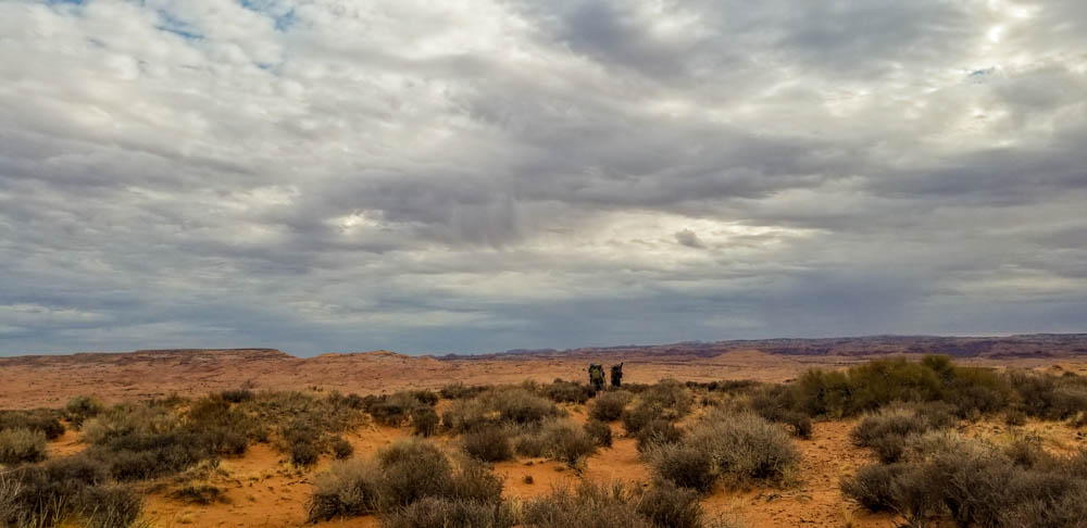
It’s just extra credit, right? Shelby has been talking about hiking on the rim of the canyons instead of in them (this was actually kind of cool), right?
A solid group effort and we find ourselves at the top of the Crack looking down to the confluence of the Escalante and Coyote Gulch. We’ve had cloud cover all morning. Everyone is doing pretty good and we are in high spirits. We drop in.
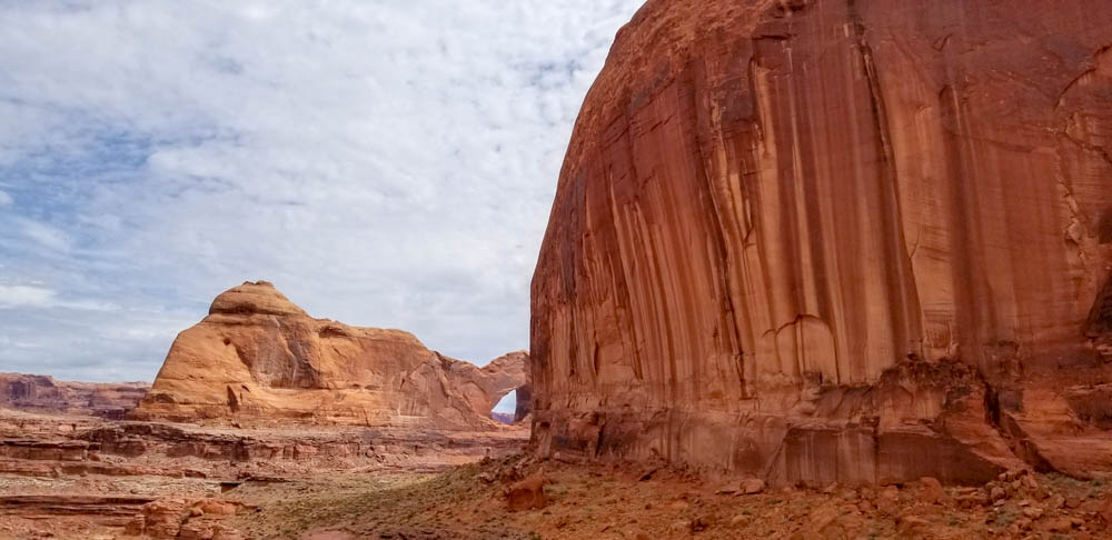
It’s hard to not be happy at this point. If you’ve never experienced Crack in the Wall, it’s an amazing view. Giant sandstone fins, Stevens (not Jacob Hamblin Arch) is beautiful and dominates the landscape. You can see the Escalante River, cottonwoods, the beginning of the Gulch. We notice the river is flooding. We all knew going into this canyon that there was the chance of floods. The Gulch is wide with the exception of 3-4 spots and it is easy to find a campsite where one is safe from floods and/or get out of the way of a flood if one does happen. With that said, flooding was definitely top of mind and at this point, probably our biggest concern.
Kathleen Ann notices that we can’t see water in the Gulch. I point out that there is water below the rock jam. We drop in. There is no water. Four years prior, the last time KB and I did this canyon in July, I had asked the ranger about water in the Gulch. He looked at me like I was stupid and said it runs year round, there is always water.
Well, there wasn’t.
We now found ourselves huddled in the tiny chunk of shade we could find. The cloud cover was gone, we had just spent 3ish hours getting to this point. We were all low on water and we had no idea what lie ahead. We drop our packs. I take a quick look around hike. There is no water upcreek. I head down and find a big hole where someone spent a good chunk of time digging to be able to get water. I stop and dig a bit myself and water pops out. OK. We also know there is plenty of water in the river.
It is decided that we will hike down to water, refill, eat lunch and then head upstream. If we haven’t hit water by the time that we have 1 liter each left, we will turn around and camp at the river and hike back out the next morning. I send a message to the Planner to see if he can get some beta on our situation as he stayed home with the kids so Cami could join us.
We run into a couple that has just dropped in behind us. They tell us that the visitor center had told them there was water around Cliff Arch. We feel a little better.
We get down to water. Shelby messages us back that there should be water within a few miles. We filter and eat. It’s hot. The couple we had seen earlier comes back down looking for water. The group heads into the Gulch. We are all a little hesitant. There is an air of doubt running through the whole group. When you have group discussions about there being two options, things can get stressful.
We round the first turn. Cami turns to Kathleen and asks her how she missed the water now at her feet. We can see KB’s footsteps up to the water now trickling in. Something has changed. The water wasn’t there before, but it’s now running. It’s clear and we are all happy again. It’s still hot, but there’s water!
A group sigh of relief is mentally released. And we begin walking.
 Drowning
It’s an interesting sensation to be worried about flooding and then switch gears to worrying about there being enough water, but that was the boat we had jumped into and we were in for the ride.
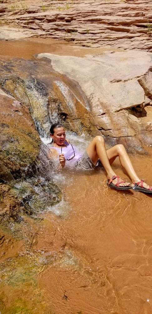
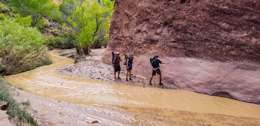
The clear water was a welcome relief from the blazing sun. As you can see from the above photo, we found some swimming holes. The clear water did wonders for our morale. If I remember correctly, everyone dunked in. It felt amazing and it was impossible to not giggle while sitting in a tiny waterfall letting water just pour over your body.
The first signs that this little oasis was going to turn on us, again, was the milk chocolate colored water that began to mix in and then take over the stream.
We found ourselves a campsite we felt would be way above high water. It had a nice sandy place, happened to be at the mouth of the Black Lagoon and next to some pictographs and ruins. It was early but we were spent. Late lunch/early dinner was prepared. Tents were set up. Some of us explored the surrounding area enjoying the thunder in the distance and the cloud cover had returned.
KB, Cami and I were at camp while Joey, Kenny and Heather were checking out the Black Lagoon and the butthole leaches that were there. KB was the first to hear it. It sounded like a big gust of wind coming down the canyon, but the leaves of the cottonwoods weren’t moving. We kept waiting for them to move.
They never moved.
At the front of the flood were a bunch of logs and branches. There was a giant log in front of our campsite. These logs hit it and the flood stopped for a few seconds until the pressure of the water behind the debris overcame inertia and that giant log went tumbling downstream. At this point, the flood was mid-shin deep. Within minutes it was a raging torrent. 2, 3, 5, 7 feet deep and growing. We watched as the water line kept creeping closer and closer to our camp.
We had camped in a perfect spot. The ruins and pictographs were probably 100 feet above the canyon floor and accessible from our camp. Our camp was well above the flood, but it gave us an option if things got crazy. We also had a giant pool of spring-fed water behind us in the Black Lagoon. We didn’t know it at the time, but that lagoon was going to be very helpful in the morning.
The flood continued to grew slowly creeping upward. It was decided that we should find a spot that was a bit higher. We packed up the tents and gear and walked a couple hundred yards to a spot about 30 feet higher than our original camp. Set up our tents and then descended back to a sandy beach to finish cooking our dinners and watch the flood in a safe spot.
We worried about the hikers we knew were downstream and those who had seemed completely oblivious to their situation that were ahead of us. No one in recorded history has ever died in Coyote Gulch from a flood, but it was still an uneasy thought to think that someone may have been in just the wrong place and that we would see them floating by with the logs and mud that was raging just a few feet away.
We tried to sleep.
Thirst
I was probably the only one worried about water at this point. I didn’t say anything because stress levels were high and for good reason. After collapsing and passing out, I woke up around midnight. The flood was still raging. I could hear it. I lay there worrying about having enough water to get out of the canyon in the morning. We had been able to filter some of the pre-flood water, but that chocolate milk color had gotten progressively darker.
Between my fears of thirst and the heat and humidity, it was a rough night. I didn’t sleep as much as I should have, but sunrise couldn’t come soon enough. I was anxious, worried about the group I had convince to drop into this canyon and who was now in a position that getting out was going to be rough.
I woke up at about 4 AM. The roar from the creek had subsided. At least we wouldn’t have to cross that torrent.
At the first sign of sun, we rolled out of bed. My first chore, figure out water. I walked down to the relatively calm stream slipping on the clay on the way down, dip my water bag in and pull out a few liters. It’s dark. There are all sorts of debris in it. I walk back to the tree where we had our makeshift filtering station. Kenny’s bag was there from the night before. The debris had settled out leaving about 1 liter of water and 2 liters of mud. This probably wasn’t going to work.
One of the reasons KB and I had ventured to the lagoon the evening prior was to see if we wanted to filter the water. We had decided against it. At that point, we were able to wait for the silt to settle and then filter the water. Things had changed. After some talk, Joey and I gathered all of the water bags and headed to the lagoon. The lagoon is literally black. You cannot see the bottom except for close to the bank. It is full of rotting cottonwood leaves and other plant matter that is blown in and then doesn’t flow out. However, it doesn’t smell and when scooped from the pool it was clear, crystal clear. We had water. At least for the time being.
This was the second “we have two options” conversations of the weekend. Those options were hiking out at Red Well. This was our original plan and where the second car was parked with the beer. The beer was a big deal. Second, we could attempt to hike out at Jacob Hamblin Arch. No one in the group had done so and after getting some beta from the Planner via sattelite text, seemed like it would probably not work out. Red Well was a jaunt from where we were.
We decided to head to the arch. KB and I would each carry an extra 4 liters of water in case we decided we couldn’t get out. That way we would have water to exit at Red Well as there was little indication that we would be able to filter the stream any time soon.
We packed up and headed out.
The arch was still there. It hadn’t been washed away. We found the route out. It was at this point that our plan kind of fell apart. To determine if we could get out, we would have to start the route. Starting the route meant a 30-foot scramble up a cliff best done without our packs. The group consensus was we were going out here. We topped off all our reservoirs and dumped what was left of our “extra” 8 liters.
Kenny and I went up first. Then we dragged the packs up behind us and the remainder of the group made it up to the first ledge. We were feeling pretty confident at this point. Ahead of us was a wall. No, it wasn’t vertical but it was damn close with plenty of exposure. There were a few people in the group who do not enjoy hate exposure. I headed up. It was climbable, but I didn’t have a pack on and there wasn’t anywhere we could stop and drag packs up. I also had the use of both of my arms. There was someone in our group who had a pretty messed up elbow.
I stopped at a relative blank spot. I can continue but it is committed and I cannot fathom how we are going to get everyone up, let alone get our gear up as well. Kenny comes and checks it out.
The group consensus is we are not going out here.
We now have a hike that in normal conditions would be a journey. On this day, the trails were gone, the creek was coated in clay and quicksand was around every corner. We moved as quickly as we could, but things just took longer. We had to route find, help each other up banks that were now vertical and covered in slickery clay. The day dragged on. What would normally take 1 hour took 2.
We hit Big Hollow Wash late in the afternoon. We had opted to skip lunch and eat snacks as long as we could. Everyone had between .5 and 1 liter of water. As long as things went normal, we should be fine. Things hadn’t gone fine yet. I scoop up some nasty flood water and carry it just in case.
The water continues a few hundred yards into the wash and then is gone. Big Hollow is wide and usually dry. The entire wash is covered in mud. That was a hell of a lot of water.
We leave the water, make our way to the last cottonwood I’ve used as a landmark that we were almost out every time I’ve ventured into Coyote Gulch. And after plenty more slipping, cursing and walking, I finally see the trail out. I ceremoniously dump the bag of dirty water I had carried for the last water and defiantly march up and out of the wash feeling quite relieved that our venture into a desert paradise was coming to an end.
P. L and R.


What an adventure. Glad you’re all safe.