 Mama Bear rolls up from behind me and asks, “Where’s the road?”
“Over there, I think,” was all I had. I was standing on the end of a road looking out across a section of river that wasn’t supposed to be there. The Smokey had done what we were told it had, taken over the road.
We had rolled into Featherville the day prior with hopes of snagging a veggie burger, an IPA (yes, I know, we are so cliché) and then heading out to make it close to the bottom of Dollarhide Summit. We had made pretty good time ticking out our minimum of 40 miles for the day before lunch. We had even stopped for a junk food picnic and beer on the side of the road before descending to our last resupply point.
By the time the two beers we had ordered were popped, but before they were sitting on the bar in front of us, we were being berated by a slightly overly excited man by the name of Pat. I’m not sure what kind of early warning system he has for cyclists coming through but it is very efficient as we learned our experience was not unique.
My brain was in low blood sugar warning mode meaning that I was understanding about 10% of what was coming out of his mouth. I’m not sure if it was my brain state or he in fact expected me to know more than I did, but I was a little lost and a little over come with the idea of whatever the hell he was talking about.
After the first beer went in, my brain started to tick. I added some French fries to the mix and ordered another cold one. Pat was informing me that there was a closed road ahead, that there was no way we could get through, that we had to take a reroute, that he had a new reroute that while not ideal was the best option and here’s the URL for the map and a printed cue sheet. Our dreams of hitting Galena the next day slowly faded into the back of my head. I was tired, sunburned and had days of road grime caked to my body. I was still wearing my cycling shoes and my helmet was sitting in the chair residing behind me. We were here for a quick one…
I ordered another beer.
 I often like to tout the idea that I don’t plan. The truth is I do. I never head out the door without some semblance of a plan, where it is that I am going and a map of some sort. If it’s somewhere I’ve been and am familiar with, that map may be mental, but it’s there nonetheless. When I say I don’t plan, I’m suggesting that I don’t like to plan and more so, I prefer to have a general idea of the what, where and how, the important details and let the rest figure itself out.
Prime example, planning for Tourdaho consisted of me buying the map and digital download of the Idaho Hot Springs Mountain Bike Route from Adventure Cycling in the winter. Looking at the map and then promptly tucking it away. In March, I planned out some dates that seemed reasonable, asked for the time off, adjusted dates to accommodate some work related conflicts and now we had a timeframe. For the next few months, I would pull out the map learn a section, memorize it and tuck it away again. As things got closer, the map lived on my desk and/or kitchen table.
I spent some time researching sticky points, like where to park your car for two weeks, like are there any roads effected by recent weather like flooding, what are the resupply points and how far apart are they. General ideas that when connected would hopefully get KB and me from Point A to Point B in some form another. What I never like to plan is where I will be each night or developing a detailed itinerary.
My planning style is probably defined by my mantra, “We’ll figure it out when we get there.”
I like things loose. I feel it adds to the adventure, not knowing where I will be each night is something I enjoy. Some of my best stories are the nights where the sun went down and I wasn’t anywhere I wanted to be, so I slept where I was. Letting the conditions dictate is part of the process and experience. It also allows for a lot of flexibility. Instead of worrying all day whether we will make it to Point A so that the next day we can hit Point B which is required to make it to Point C by 6 pm for check in, is not my style or what I want to be thinking about while I’m rolling along.
 I woke up at exactly 1:30 AM. Mama Bear immediately grumbled. I was in a cold sweat. We were both physically shot and had mentally prepared for one last big climb. Thinking about making Kathleen climb another 300o feet over terrain that one person described as unrideable and that took 4 hours to go 14 miles, was not something I wanted to do. I grabbed my phone and began searching.
We had decided to stay in Featherville to regroup and prepare for our push toward Dollarhide. We had resupplied as best we could, I had the reroute saved on my phone and we were going to push forward. I just couldn’t swallow that we had such a rough day ahead of us when we were so close to being done.
My search resulted in a few forum comments and some videos showing the rock slides that were blocking the road. The last few comments were a consensus that the road would go and pushing through wasn’t ridiculous. I put the phone away as KB moved to the other bed in the room so she could sleep. I tossed and turned until the alarm went off at 5. I showed her the videos and we decided to make a run of it.
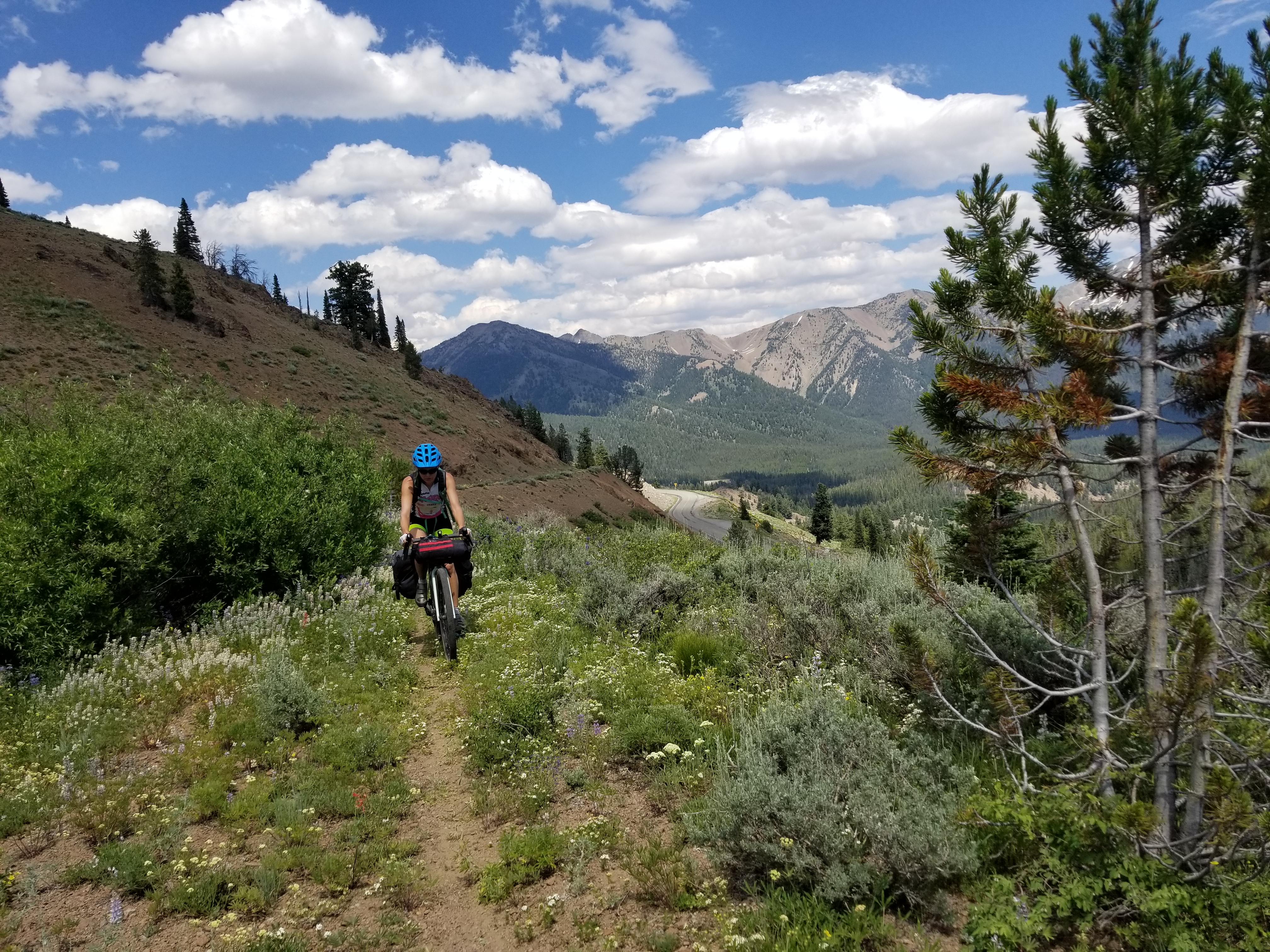
We had 14 miles from Featherville to the turn off for the reroute followed by 7 miles of unknown. We made that flat section in good time. The weather had turned on us and it was drizzling. Our packs were adjusted to ensure that at a minimum our sleeping bags would be dry when we needed them. We rode right past the road closed sign following several tracks ahead of us.
 The road was in good shape as we continued into no man’s land. As we knew we would, we came to a rock slide. There was a fairly well beaten path through it. We changed shows and hoisted our loaded bikes onto our backs and within about 20 minutes we were on the other side. There was another road closed sign for those coming from the other direction. We thought that was pretty easy and giggled as we changed back into our tap shoes and headed on.
We hit the second rock slide shortly after. You could tell it was much newer as the path was almost nonexistent, but it was there. Things were damp as the rain continued. We should’ve changed our shoes but we didn’t. Despite one close call which I was glad Kathleen didn’t see, we made it to the other side where there was once again a road closed sign. And this time there were recent tracks from motorized vehicles in addition to the bike tracks we had been following. We pedaled on, stopping on occasion to find our way through a road wash out. These wash outs got worse and worse.
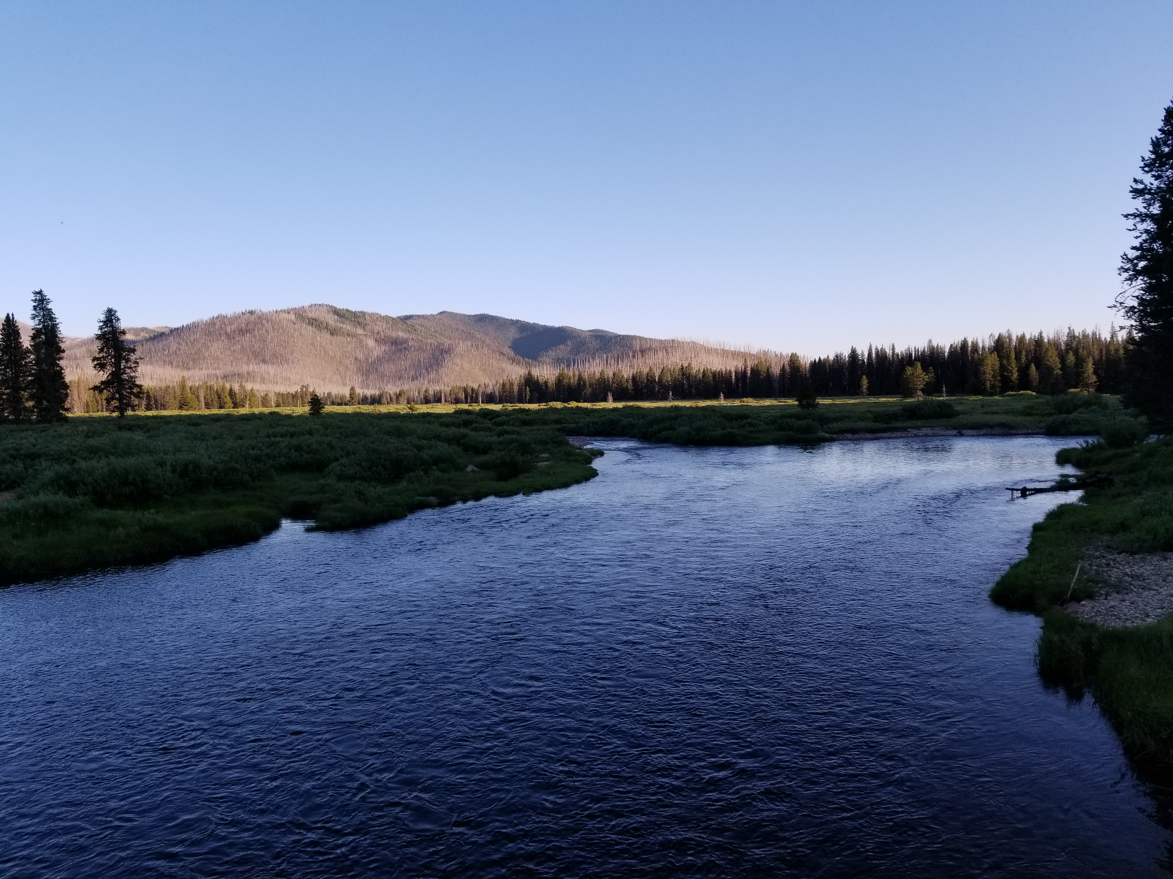
And then we were standing on a 4 foot drop into a river that we didn’t want to cross. It wasn’t until this point that I thought maybe, just maybe we should’ve listened to Pat.
I could see a look of despair on Mama Bear’s face, but I also knew we had been in worse spots and we soldiered on. I managed the bikes down the bank. We crossed a shallow section that led us another 50 yards or so up stream where we forced to cross the river. We took the panniers off of KB’s bike and I carried the two bikes across and helped her as she carried her bags. Once on the other side, we had little option but to continue across the rock bar which had an obvious outcome, cross the river again.
We repeated the process. Upon carrying Kathleen’s bike across, I slipped and her bike’s front wheel dipped into the river pulling me down leaving only my left should dry. I was able to recover and got her bike on the bank. I turned around and found her waiting on the other shore, she said nothing. I helped her across and then made the last journey over to where my bike was waiting. This time I ensured that the bike was not in any danger of hitting the water and we were across. We pushed the bikes through the bushes and onto the road.
We once again passed a road closed sign and houses appeared. We knew we had made it.
 Our original plan from the day prior was to hit this point and find a place to camp allowing us to climb the summit in the cool of the morning. I was soaking wet, we were both a little taxed mentally, but it was early and we had just ticked off about 30 miles with some serious obstacles. We moved on till we hit where we probably would have camped, ate some lunch and then decided to go for it. We had about 15 miles to the top of the summit and then a whole bunch of downhill to Stanley.
But that’s a whole ‘nother story that we had to figure out when we got there.
P. L. and R.
![]()