 Climbing mountains can certainly be perceived as being a pointless activity. One of the first men to attempt the summit of Everest, George Mallory, said he wanted to climb the mountain “because it’s there.” Sometimes I wish I had a better reason to do the things that I do, but when I’m honest with myself, it’s just to get away. There’s no noble intentions, no cause that drives me forward in my mediocrity. Nope, it’s pretty much just the desire to play instead of work.
Of course, “they” will tell you that there is a time to work and a time to play and as great as that sounds, there’s always more time for work than there is for play. At least for ordinary schmucks like myself that have to work for what they call a living despite how much it feels like working so we can hopefully live for a little on the weekends.
 It was a simple plan for a simple group. Drive to the trailhead, spend a few days making our way to the base of King’s Peak, summit and then make our way back to the car and the six hour drive that would get us back to our 9-5 gigs, our houses, our chores, our work.
When the plan was made, there were 6. Then there were 5. And by the time we hit the trailhead there were three of us, KB, Brother Meinkey and myself.
I had never been to the Uintahs so my stoke was pretty high. After our trip to Mount Wheeler and a fresh prescription of steroids, I felt confident there would be no issues making it to the top which meant that my fear of being above treeline had vanished and going back to the mountains was all I could think about leading up to the trip. Even the thought of having to drive for six hours before even getting to start did not dampen my spirits, nor the fact that I would not be bringing any spirits with me.
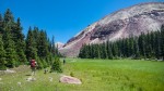
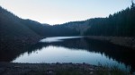
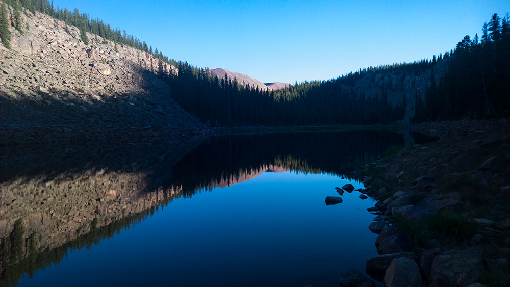 We made it to the trailhead in the late afternoon. Seeing that we would be hiking close to water for much of the climb up to the base of the peak, we figured we would hike till we ran out of daylight or energy, whichever came first. We hit the above lake when both were just about done. It wasn’t a bad place to lay down for the night.
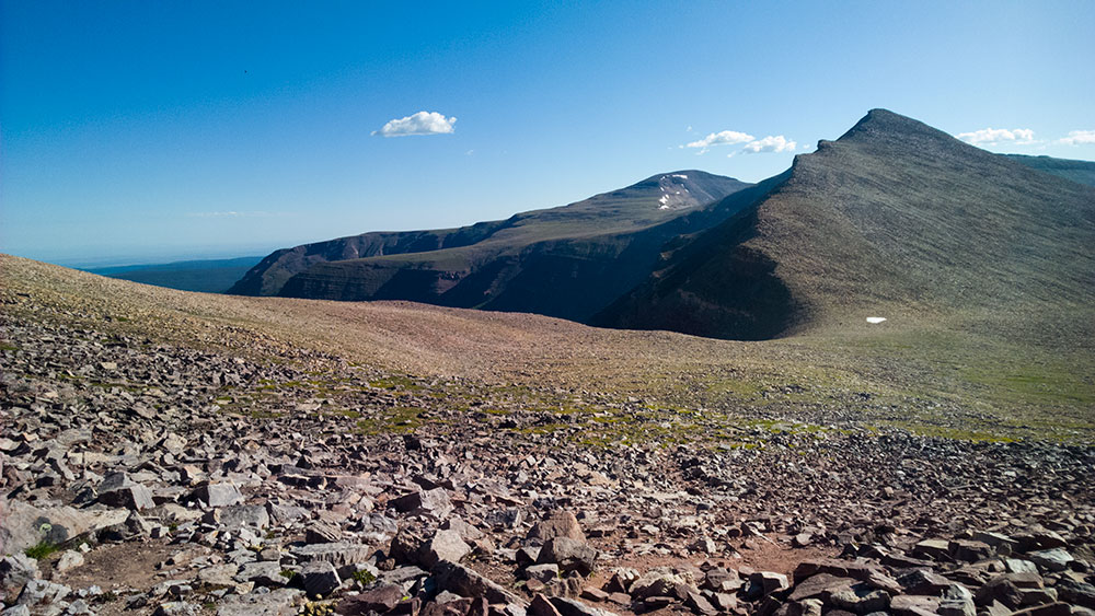
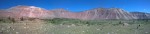
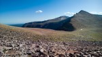
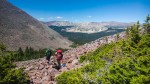
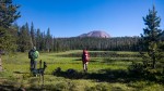
 Day two we hoped to make it to the base of the peak which could be about 10 miles away or about 15 miles away depending on how we went and whether a bushwhack shortcut was actually shorter. The biggest obstacle was going to be Blue Bell Pass which we could see looming in the distance as our footsteps dragged us closer. At over 11,000 feet Blue Bell would take us out of the trees and into the high Uintahs.
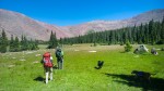
 Once over Blue Bell, we made our way to Milk Lake where we stopped for lunch. I was done. We had only walked about seven miles, but the elevation had started to get to me. I was able to keep up but felt fatigued beyond what I think anyone would consider normal. After a large lunch and a good hour nap, I popped a pill as we continued on. Within a few minutes, the lights came back on.
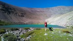
Milk Lake was more or less where our shortcut was supposed to start. We could see where we needed to go. Having a giant ridge to follow is almost as easy as tripping our way down a trail.
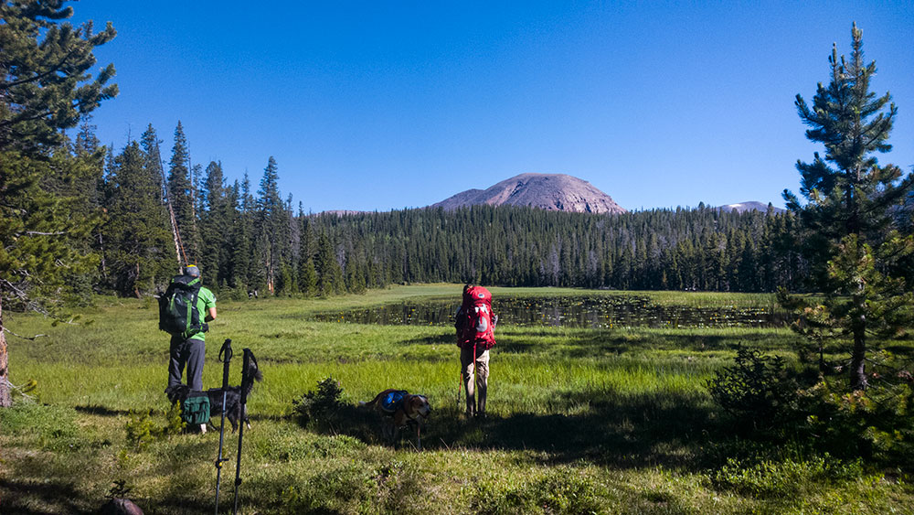
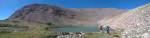
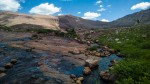
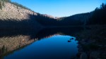
 We hit King’s Lake and it was time for water pumping. The water was a strange shade of turquoise, but tasted fine once forced through a filter. We usually don’t hike with the dogs when we do long trips. This would be there first multi-day adventure in a few years. To say they were tired would be an understatement. At King’s Lake, they both bedded down and were asleep by the time I had filtered a liter of water.
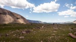
 Even with peaks to guide you, there is always a little nagging voice in the back of your head questioning if you are going the right direction or if you will hit the trail again where you think it is. Will the shortcut be shorter or will it cause you to backtrack to find your way costing you time and mileage? Are you even following the right ridge? Why doesn’t the gps work on this paper map? Things like that.
We first tried to go over the a large boulder field around the base of the ridge, but knowing how far we were from motorized travel and the fact that the boulders were big enough to require hopping from one to the next encouraged us to drop down and skirt the base of the giant pile of rocks. This turned out nicely as we rounded a turn and found the above trail right where we had hoped it would be.
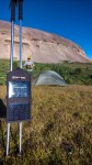
 Unplugged? Not for this group. I never thought I would need a solar charging station on a backpacking trip, but after purchasing one to keep my phone and gps charged on last year’s JMT attempt, there have been few trips longer than overnight when these panels haven’t seen the sun and had something plugged into them. Bro. Meinkey was packing around his camera and using his phone for navigation. When we made it to what would be our second campsite, the sun was dropping in the sky and it was clear there wasn’t much energy to be sucked from them.
If I recall correctly, he got everything charged back up before the last rays dropped behind the ridge.
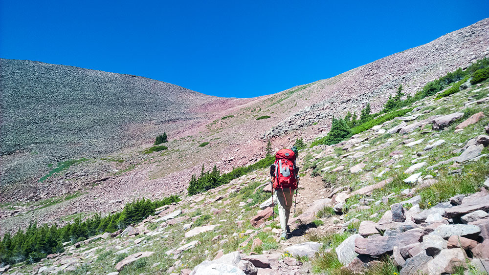
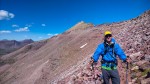
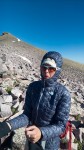
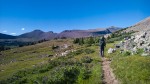
Day three: Walk. That’s what we had come to do and that’s what we did. We walked to the highest point in Utah.
We stripped our packs of everything that was unnecessary and began the walk to the highest point in Utah. First, we continued over the tundra to the base of Anderson Pass. Second, we walked up the pass. Before we hit three, it’s important to note that at this point we had only seen one other person on the trail. A veritable BAMF if we were to believe that she was capable of completing the route she told us she had planned. Which was to continue from just above our camp 2 to the summit and then follow the ridge back around and down to the Swift Creek trailhead, in one day. I have no idea whether she could, did or how she got out, we never saw her again.
3. From the pass, the trail disappears and you venture into a boulder field.
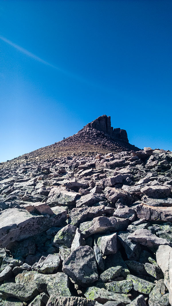 There’s only one way to the top and that’s to continue moving. And we were motivated to do so by the throngs of people we could see ascending the pass from the other side. It was clear that our virtual solitude was about to end. There was a solo hiker ahead of that summited first and left us on top by ourselves.
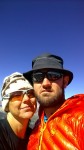
We snapped the obligatory selfies, high fived the sky, tried to take in the immensity of the views surrounding us and then turned around and came right back down.
There were no visions, no tears, no cheering. In fact, there was a sense of this point, this peak being the beginning of the end to our escape. As I descended, I felt a little disappointed that the trip was coming to a close. We had one more afternoon of hiking, one more campsite and then out to the car. We were essentially an overnighter way from having to get back to work.
It’s never enough.
The video.
The pictures.


The maps.
P. L. and R.
![]()